

★☆★☆★☆★☆★☆★☆★☆★☆★☆★☆
PRESS FOR NOAA Ocean Buoys
“The official NOAA buoys are essential tools that pro surfers use, and you should too. This app is definitely a steal.” – Surfer Magazine
"’Its actually great for figuring out whats going on when you wake up in the dark and need figure out whats going on, without leaving your bed’ […] If the surf hasnt cleaned up yet, or the swell hasnt arrived, no one wants to stumble out into a 40-degree morning […] Its also good for getting real time info to track a swell, watching the numbers rise or fall.” – www.espn.com
The app “processes countless data from NOAA’s buoys and displays it in an easy-to-read format on your phone.” – Eastern Surf Magazine
★☆★☆★☆★☆★☆★☆★☆★☆★☆★☆
DESCRIPTION
The NOAA Ocean Buoys application provides users with access to live data transmitted from over 120 buoys scattered throughout North America, Alaska, Hawaii, Canada, Europe, and the Caribbean. Most buoys provide information about current wave heights, wave periods, wind speed, wind direction, air temperature, water temperature, atmospheric pressure, pressure tendency, and dew points. One of the best tools for professionals and general enthusiasts alike.
THIS APPLICATION IS PERFECT FOR:
Surfers
Sailors
Mariners
Fisherman
Divers
Wind surfers
Kite boarders
Kayakers
Lifeguards
Beach goers
and anyone else looking to know current conditions of the oceans and beaches near them.
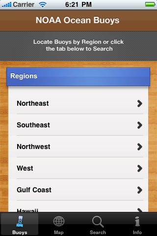
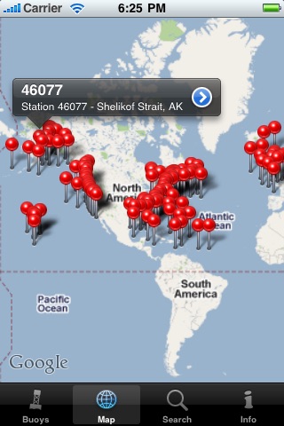
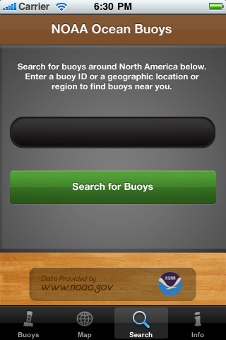
FINDING BUOYS
Buoys can be found based on their region or by using the interactive map provided that uses precise GPS coordinates of each buoy’s location to create a visual tool to find buoys of interest. Buoys can also be searched for by their station Id’s or using search terms that may describe their location.
BUOY LOCATIONS
Over 170 buoy locations available. Buoys are available in the following regions:
East Coast U.S
West Coast U.S
Gulf Coast U.S
Great Lakes U.S
Hawaii
Alaska
Europe
Canada
Canadian Maritimes
Caribbean
For a detailed map of locations please visit: http://www.ndbc.noaa.gov/
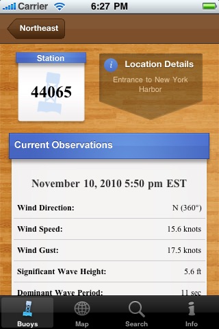
DATA AVAILABLE
There are many types of data available by buoys. Different buoys may display different types of data depending upon their buoy type but may include any of the following:
Wave Heights
Wave Periods
Swell Direction
Wind Speed
Wind Direction
Air Temperature
Water Temperature
Atmospheric Pressure
Pressure Tendency
Dew Points
Data for buoys is provided by the National Oceanic and Atmospheric Administration.